Taylors Mistake
Pocket beach · Deposition landform · SECCE
The landform
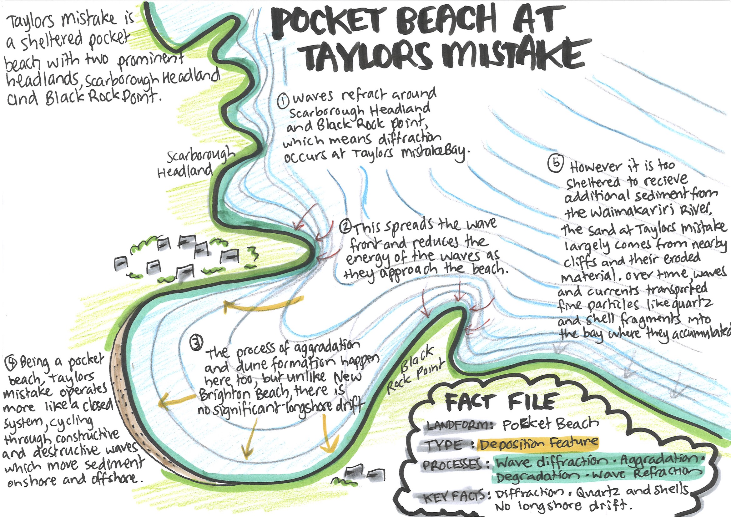
Taylors Mistake is a sheltered pocket beach with two prominent headlands.
Waves refract around Scarborough Headland and Black Rock Point, which means that diffraction occurs in Taylors Mistake Bay. This spreads the wave front and reduces the energy of the waves as they approach the beach. The processes of aggradation and dune formation happen here too, but unlike New Brighton Beach, there is no longshore drift.
Being a pocket beach, Taylors Mistake operates more as a stable closed system, cycling through phases of constructive and destructive waves which move sediment onshore and offshore during different weather patterns. However, it is too sheltered to receive additional sediment from the Waimakariri River. The sand at Taylors Mistake largely comes from eroded material from nearby cliffs. Over time, waves and currents transported fine particles like quartz and shell fragments into the bay, where they accumulated.
The diagram
Fact file
- Landform
- Pocket beach
- Type
- Deposition feature
- Processes
- Wave diffraction · Aggradation · Degradation · Wave refraction
- Key facts
- Diffraction · Quartz and shells · No longshore drift
Time-lapse video of the diagram
Using it in the exam
Question A (how processes shaped the environment): Taylors Mistake is one of the deposition features you can choose from. On your map, label it with its landform type and place name, and add a short caption, for example:
“Isolated pocket beach cut off from sediment supply.”
Question C (spatial variation): New Brighton and Taylors Mistake are both beaches affected by constructive and destructive waves. However, the barrier beach at New Brighton has longshore drift and a sediment supply from the Waimakariri River, creating a spit at the end of the beach, while Taylors Mistake is a pocket beach with a closed sediment system.
Temporal variation: the difference between summer and winter beach profiles (the shape of the beach slope above and below the water) applies here too, since the beach building processes are the same as at New Brighton.