Southshore Spit
Spit · Deposition landform · SECCE
The landform
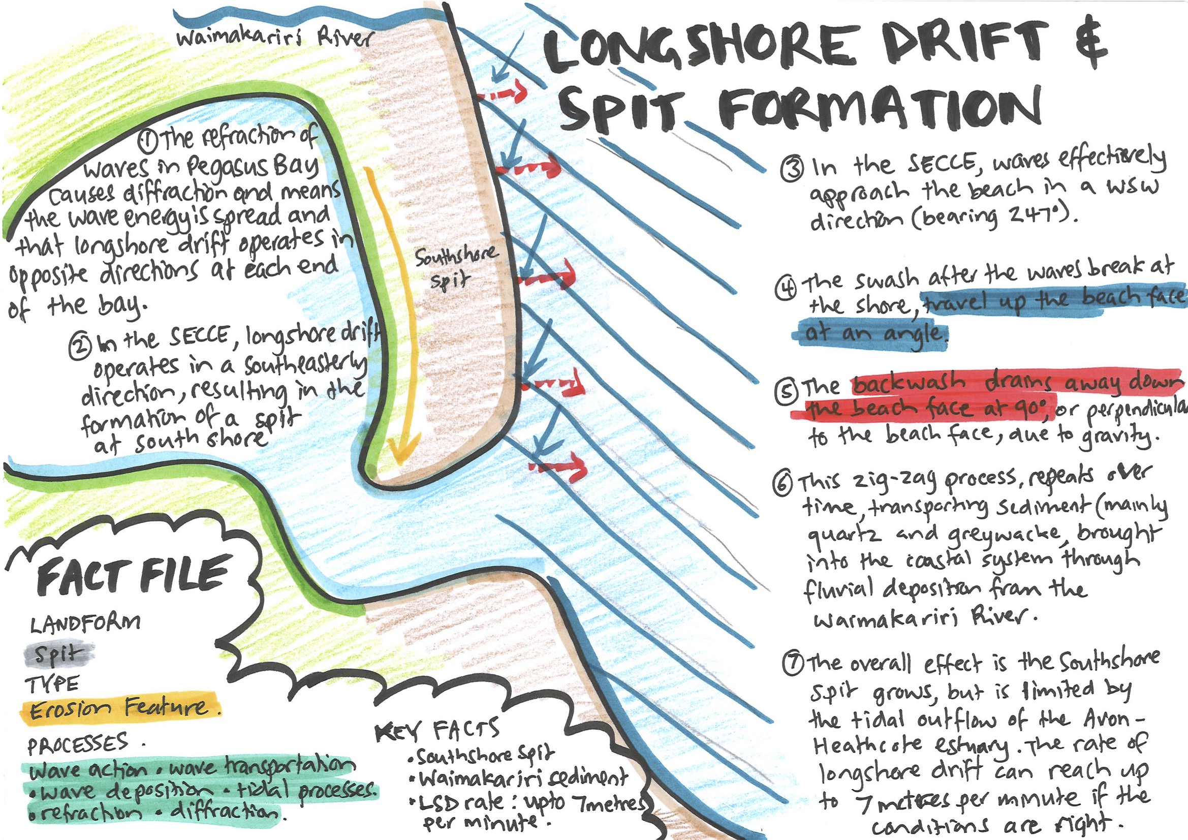
The refraction of waves into Pegasus Bay causes diffraction of the waves. This spreads the wave energy and means that longshore drift operates in opposite directions at each end of the bay. In the SECCE, longshore drift operates in a south-easterly direction, resulting in the formation of a spit at Southshore.
In the SECCE, waves effectively approach the beach in a predominantly WSW direction (bearing 247°). The swash travels up the beach at an angle, and then the backwash drains away down the beach face, perpendicular to the beach at a 90 degree angle, due to gravity. This process repeats over long periods of time, transporting sand and sediment (mainly quartz and greywacke, brought into the coastal system through fluvial deposition by the Waimakariri River).
The sediment travels in a south-easterly direction along New Brighton Beach, forming a spit between the Pacific Ocean and the Avon-Heathcote Estuary. The spit has a limit on how far it can extend, because the tidal draining of the estuary causes strong currents that push sediment out to sea.
The diagram
Fact file
- Landform
- Spit
- Type
- Deposition feature
- Processes
- Wave action · Wave transportation · Wave deposition · Tidal processes · Refraction · Diffraction
- Key facts
- Southshore Spit · Waimakariri sediment · Longshore drift rate up to 7 metres per minute
Time-lapse video of the diagram
Using it in the exam
Question A (how processes shaped the environment): the spit at Southshore is one of the deposition features you can choose from. On your map, label it with its landform type and place name, and add a short caption, for example:
“Spit built south-east by longshore drift, using sediment from the Waimakariri River.”
Question C (spatial variation): New Brighton and Taylors Mistake are both beaches affected by constructive and destructive waves. However, the barrier beach at New Brighton has longshore drift and a sediment supply from the Waimakariri River, creating a spit at the end of the beach, while Taylors Mistake is a pocket beach with a closed sediment system.